Identifying Suitable Bald Eagle Habitats in Manitoba with ArcGIS Pro
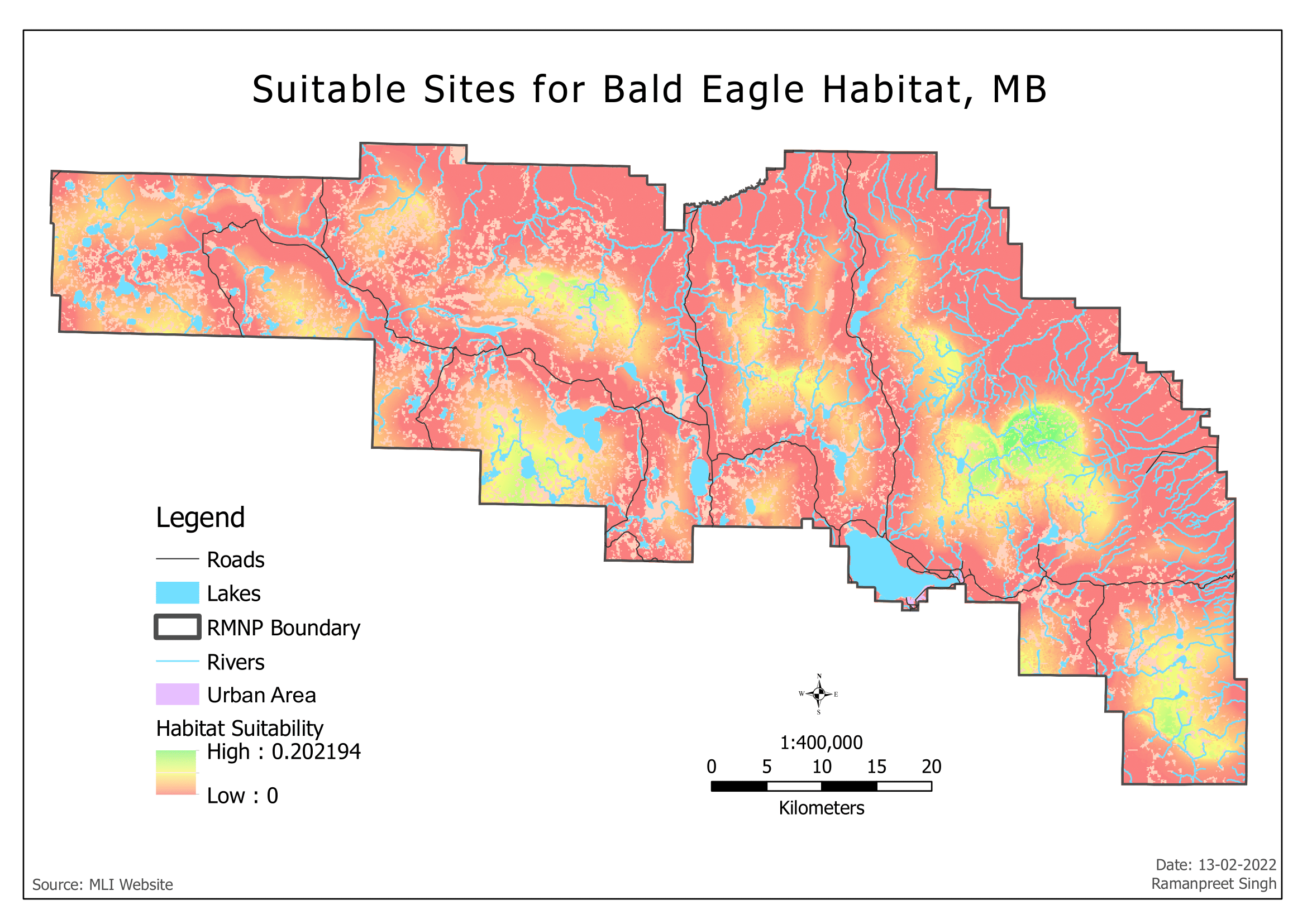
This project is a comprehensive study that identifies suitable habitats for bald eagles in Manitoba, Canada. The project utilizes ArcGIS Pro to analyze various geographical and environmental factors that contribute to the suitability of a habitat for these majestic birds. The resulting map is color-coded, with green indicating the most suitable areas and red indicating the least suitable ones. The map also incorporates other geographical features such as roads, lakes, rivers, and urban areas, providing a holistic view of the region. This project demonstrates the power of GIS in wildlife conservation efforts and habitat studies.