Brandon Hills Elevation Map
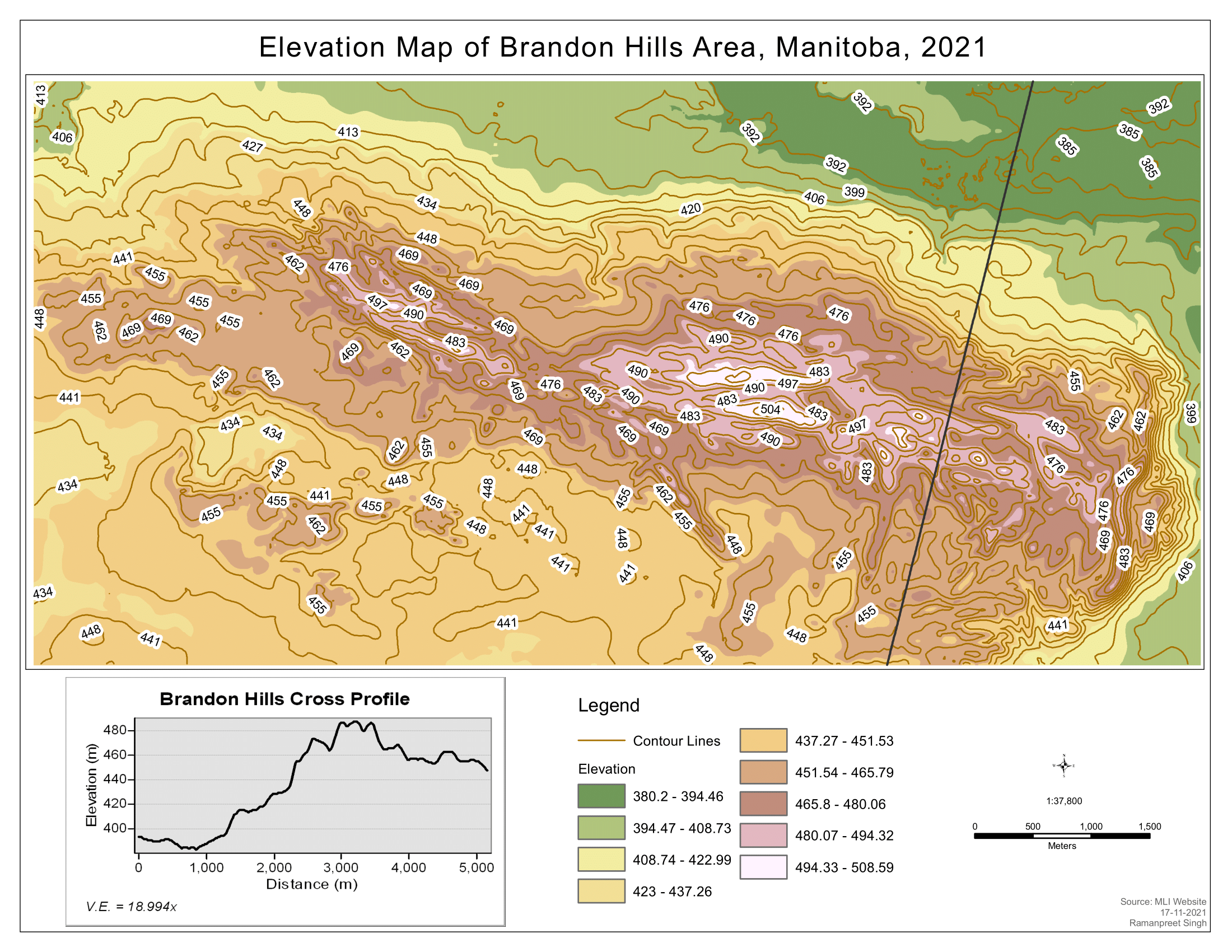
This is an intricate and detailed elevation map of the Brandon Hills area in Manitoba, created using ArcGIS Pro during my college project. The map is beautifully rendered in shades of brown and orange, representing the varying elevations of the terrain. The map is enhanced with white contour lines that add depth and dimension, providing a clear visual representation of the terrain’s undulations. This map not only serves as a geographical tool but also as an artistic representation of the Brandon Hills area, demonstrating the blend of science and art in cartography. It stands as a testament to my skills in GIS and my ability to transform raw data into a visually appealing and informative piece.