Manitoba Unmasked: A Multispectral Imagery Analysis with ArcGIS Pro
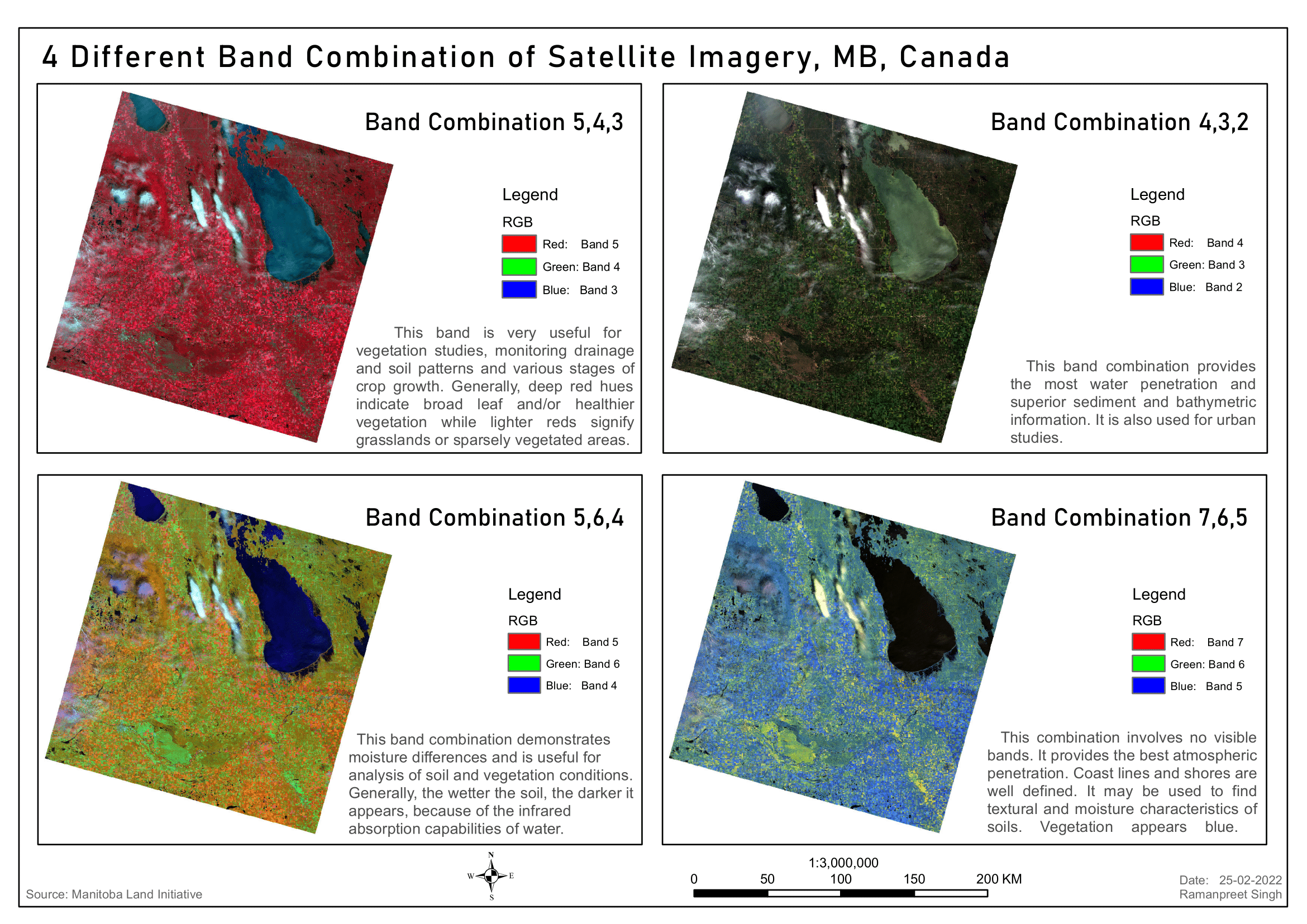
‘Manitoba Unmasked’ is a multispectral imagery analysis that reveals the hidden layers of Manitoba’s geography. The project uses different band combinations to study and interpret the region’s diverse ecosystems. This insightful exploration was made possible by the advanced features and functionalities of ArcGIS Pro.